Hydrology | Groundwater | Surface Water
Hydrology Publications | Experimental Watershed | Watershed Map
Beaver Creek Hydrology
Our discussion of Beaver Creek hydrology is divided into two parts--groundwater and surface water--for purely organizational purposes. It is important to note that in many watersheds the two cannot be separated. Many streams in the southwestern U.S. are hydraulically connected to both overlying and underlying aquifer units, meaning that water passes from the stream to the aquifers and vice versa at certain times of the year and under certain conditions. This is important when it comes to managing water resources in semi-arid watersheds. The Beaver Creek watershed is exceptional, as the hydraulic connectivity of the stream to the underlying aquifer is limited, while the stream receives much of its perennial flow from springs issuing from the overlying aquifer.
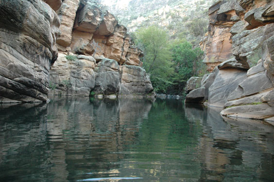
One of several pools located along Wet Beaver Creek
Important groundwater concepts include the aquifer characteristics and aquifer dynamics. Groundwater is water that is stored underground, within porous rocks and/or sediments that make up the aquifer. Information about groundwater within the Beaver Creek Watershed is limited, so the information provided here is largely interpolated from regional aquifer data for the Colorado Plateau and the Verde Valley. Groundwater in the Beaver Creek Watershed is potentially stored in several different rock units, including the Devonian Martin Formation, the Pennsylvanian-Permian Supai Formation, the Triassic Moenkopi Formation, the Tertiary Volcanic Rocks, the Tertiary Verde Formation, and the Quaternary Alluvium. Other units that play a role in groundwater infiltration are the Permian Toroweap and Kaibab Formations and the Triassic Moenkopi Formation.
Important surface water concepts include runoff, streamflow, erosion, and sedimentation. The Beaver Creek Watershed is defined by three major stream segments: Beaver Creek proper, Wet Beaver Creek, and Dry Beaver Creek (click here to view the Watershed Map). The upper two-thirds of the watershed is defined by Dry Beaver Creek, an ephemeral, or intermittent, branch of the main stream; and by peripheral streams that eventually drain into one or another branch of Beaver Creek. The southernmost portion of the watershed is defined by Wet Beaver Creek, a perennial branch of the main stream.
Beaver Creek is an outstanding area for conducting aquatic studies in Domain 13 because it has the representative hydrology, water issues, and is designated as an experimental watershed and UNESCO Man and the Biosphere Reserve to specifically address water-related issues. It typifies southwestern U.S. hydrological system, with both perennial and intermittent reaches, drought-flood cycles, and hydraulically connected surface and groundwater. Beaver Creek is a major drainage into the Verde River, which then flows into the Salt River, providing water to the expanding Phoenix metropolitan region, the fastest growing urban area in the USA. The growing communities of Sedona, Oak Creek, Lake Montezuma, Rimrock, and Camp Verde all place significant demands on available water. Exotic fishes and crayfish provide a challenge to restoration of the perennial Wet Beaver Creek, while beavers are actively restoring pond habitats in Dry Beaver Creek. There are currently ten active stream gauges distributed in the upper portion of the watershed (Figure 3). Stoneman Lake, a permanent natural lake, is also located in the upper portion of the watershed. Paleoenvironmental work in Stoneman Lake has documented 9,000 years of vegetation change in the watershed (Hasbargen 1994).
Click here for more detailed information on the Beaver Creek Watershed's Hydrology

Figure 3. Because of it's status as a designated Experimental Watershed, the Beaver Creek Watershed has 4 active weather stations (2 located at the administrative sites), 10 active stream gauges, and 38 precipitation gauges. Several beaver ponds have recently been documented along Dry Beaver Creek.