| 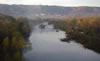
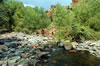
Site1: Verde River/Beaver Creek Confluence
Where Beaver Creek flows into the Verde River, we see the "highway interchanges" of pre-history.
|
|
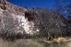
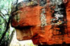
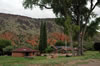
Site 2: About Montezuma Castle
Set within a limestone cliff overlooking Beaver Creek in Arizona 's Verde Valley , the prehistoric ruin known as Montezuma Castle has stood for hundreds of years, a witness to great changes in the surrounding cultural and natural landscapes. The Castle, which the Sinagua people built and occupied from as early as 1200 A.D. until their departure from the Verde Valley more than two hundred years later, now serves as a reminder of the prehistoric cultures that once flourished in the region. Though these groups prospered, developing sophisticated cultures as well as agricultural and trade-based economies, they abandoned the Verde Valley entirely by 1425 A.D.
|
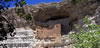
How to get to Montezuma Castle
Montezuma Castle is located 3 miles off Interstate 17. Use Exit Number 289; the access road is 1/2 mile past the Cliff Castle Casino at the traffic light. Entrance fee is $3 for a one week pass. Open every day 8am-5pm. The monument visitor center contains exhibits and information regarding your visit. The 1/3-mile paved trail will take the visitor on a leisurely walk to view Montezuma Castle and other prehistoric dwellings.
|
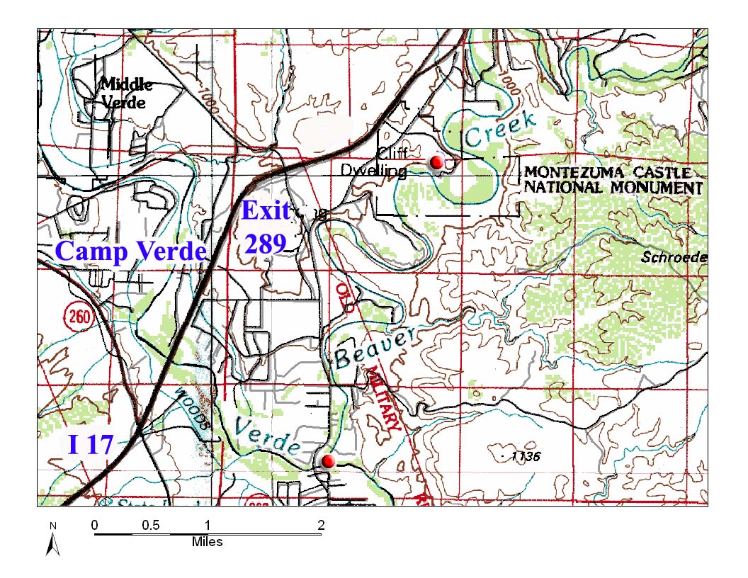
Sites 1 and 2: The Confluence and Montezuma Castle |
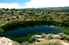
Site 3: Montezuma Well
To get to Montezuma Well take Exit 293 east from I-17. Drive 4 miles on Montezuma Highway. You will find a 1/3-mile trail up to the well. |
Inside the Well
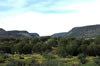
This well formed as a sink hole, a collapsed underground limestone cavern filled with water. Its water is a precious resource to residents of the Verde and Salt River Valleys, so it must be managed and used wisely. Montezuma Well is 368 feet across by 55 feet deep. |
Canal from the Well
The Sinagua people discovered this water source and supported an agricultural community with it and the nearby creek from about 800-1425 A.D. This canal can be found off the Well Trail. |
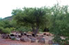
Site 4: Canals and Picnic Area
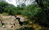
The parking area south of the well is for picnicking. As you enter, and all around nearby the picnic area, you will see remains of ancient irrigation canals, some restored for use today.
|
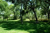
Well Picnic Area
A picnic area just south of the Montezuma Well entrance provides a grassy plain to relax and eat. |
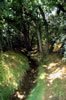
Small Canal Trail
One can imagine the surrounding agriculture these small canals supported for the historic native cultures once inhabited this desert oasis. |
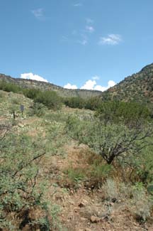
Site 5: Lawrence Crossing Ancient Agriculture
Sinagua agricultural fields are located on the east side of the creek. The parking area is actually in the middle of Sinagua agricultural fields. They used tiny rock wall compartments laid out on a grid to catch water, which they fed into
the area by irrigation canals. The easiest place to see the fields is on the north, or right, side of the road. Look for rows of cobble-sized rocks sticking about 4"-6" out of the ground. The rows are about 6"-12" across. In some places you will see most or all of the compartments, which measure about 10 ft x 10 ft. It's definitely subtle! Once you find the more obvious ones, you'll start noticing the "waffle" pattern everywhere. You don't need to be too far from the road to see the fields. |
To get to Lawrence Crossing:
To get here from Beaver Creek Road going north from Rimrock, take a right at the fork just past the Well and take the next right to Beaver Creek. You may need a car with decent clearance.
To get here traveling south on FR 618, go up hill just past V-V and pass Sacred Mountain; continue down the road for about a mile after that. Turn right on FR 618G. This section will require a car with decent clearance. Drive across a wash with a ledge of red slickrock. Follow the road until it dead ends at .7 miles, where you can park. |
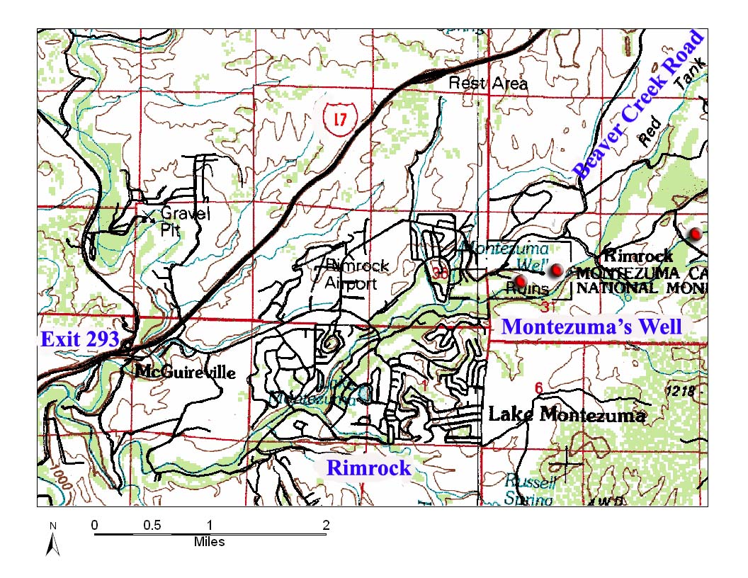
Sites 3-5: Montezuma Well, Canals, and Ancient Agricultural Fields |
Site 6: Gaging Station on Red Tank Draw
Take FR 618 east from Exit 298 off I-17 until you see the first forest road turn off to the north. This road will take you to another fork where you will take the middle road of a three-way fork. Then take a right at the next fork to the creek. This gage is used to measure stream flow and has been monitored for over half a century.
|
FR 618 is one of the Coconino National Forest's scenic drives. This road is also accessible from Site 4 by continuing north for 2 miles on Beaver Creek Road from Montezuma well. |
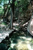
Red Tank Draw
Continuing on FR 618 for about 1.3 miles will take you to Red Tank Draw, an important ancient travel route for Sinagua people descending off the Rim. |
Red Tank Draw Creek
Park in the large pullout on the right (southwest) side of the road (FR 618) just before the Red Tank Draw bridge. Parking here will orient you toward petroglyphs below. |
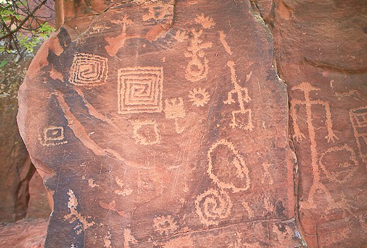
Site 7: Red Tank Petroglyphs
Petroglyphs are on the large boulder shaded by a Juniper tree on the right side of the road (FR 618). They face the stream less than 50 feet from the parking area. All the petroglyphs seem to be oriented to people descending on the old travel route, which roughly parallels Wet Beaver Creek. |
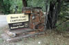
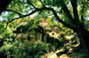
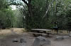
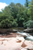
Site 8: Beaver Creek Campground
The Beaver Creek Campgrounds are located next to the creek 3 miles down FR 618 from Exit 298 off of I-17, just before the Beaver Creek Bridge. Amenities include drinking water, grills, vault toilets, and 13 year-round camp sites. $14/night.
928-282-4119 Sedona Ranger District. |
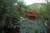
Beaver Creek Bridge
Great swimming spot. As you approach this 20- to 30-foot wide stream you'll see huge piles of rocks, deposited by episodes of high water. Towering sycamores and other hardwoods line both banks of the stream. |
Camp
The cool, clear waters of nearby Wet Beaver Creek provide an excellent place to fish, hike, swim, wade, and birdwatch, all within a few steps of your camp site.
|
Beaver Creek Picnic Grounds
The Beaver Creek Picnic Area is just across the road from the camp.
|
Site 9: Southwestern Academy / Beaver Creek Ranch
Southwestern Academy offers high school college preparatory summer classes at the Beaver Creek Ranch.
|
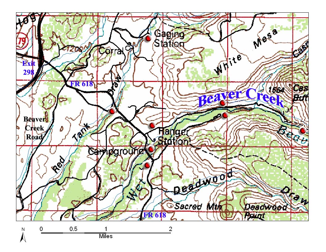
Sites 6-13: Red Tank Draw, Beaver Creek and Bell Trail Sites |
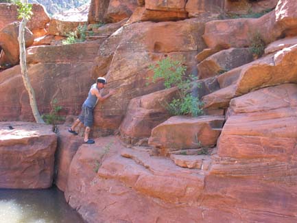
Site 10: V Bar V Petroglyphs
Here you will find more than one thousand petroglyphs created by the Sinagua toward the end of their stay in the region. A volunteer at the site will point out and explain some of the symbols on the cliff face. Open only Fri-Mon 9:30-4:00. Bring a Red Rock Pass to get in. From paved Forest Road 618, turn right at the fork just past the Beaver Creek Bridge. A 1/3-mile trail takes you to the petroglyphs. |
Old Ranger Station |
Site 11: Bell Trailhead (#13)
A trailhead provides access to hiking trails into the Beaver Creek Wilderness.Go east on FR 618 from Exit 298 about two miles and take a left on FR 618A, which leads to a parking area at the trailhead. |
Site 12: Bell Trail Petroglyphs
North of this point along the Bell Trail you will find petroglyphs on a boulder surrounded by cactus, roughly facing the creek. You'll know you're near this point when Beaver Creek Ranch/ Southwestern Academy housing is visible directly across the creek.
|
Casner Canyon
Around the corner, the confluence of Casner Canyon and Wet Beaver Creek is located where the Bell trail meets the first canyon to the north. From here you can see Casner Butte to the northeast, the White Mesa trailhead, and the Apache Maid Trail. These were other important byways of the Sinagua.
|
Site 13: Beaver Creek Weir / Gaging Station
The Wet Beaver Creek gaging station, near Casner Canyon, is accessibly via the Weir trail from a fork off the Bell trail. This gage is used to measure stream flow. |
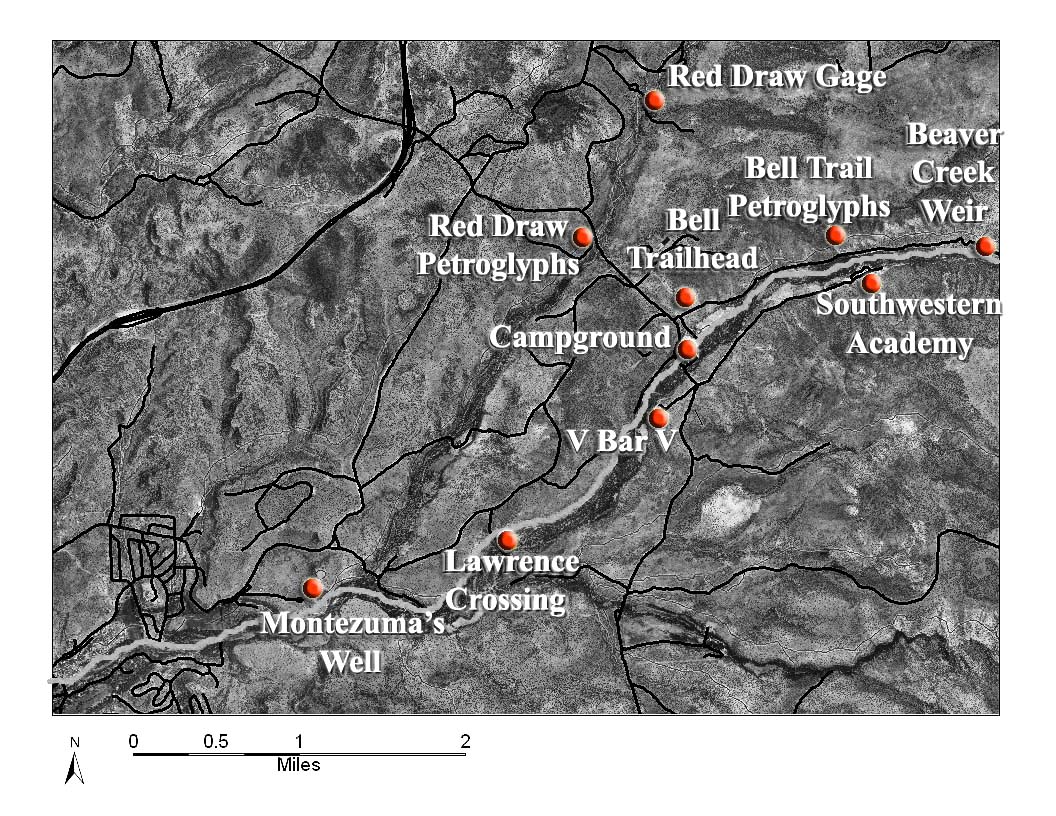
Sites 3-13: SItes off of Forest Road 618 |
Bell Crossing
The Bell Trail continues upstream to Bell Crossing (3 miles total from trailhead). Adventurous hikers can continue upstream if they're willing to swim through many deep pools. Alternatively, crossing the creek climbs out to the east to Roundup Basin and Forest Road 214 near Five Mile Pass; you'll cover 10.8 miles one way and gain 2,450 feet in elevation.
|
MORE:Take a Virtual Tour of the creek from the Merriam Powell Center for Environmental Research website. The tour provides 360-degree views of selected sites along the creek.
Visit the Coconino National Forest Red Rock Ranger District site for more information on the the area.
|
| Keep an eye open for Beaver Creek ecology: Sycamore, cottonwood, ash, alder, Arizona walnut, and wildflowers grow along the creek. A short way from the water, the prickly pear cactus, agave, Utah juniper, and pinyon pine of the high desert dominate. Mules, white-tailed deer, ringtailed cats, coyotes, javelinas, Gambel's quail, red-tailed hawks, bald eagles, and great blue herons inhabit the area, along with rattlesnakes, tarantulas, black bears, and poison ivy. Verde trout, some brown and some rainbow, and suckers live in the creek, though most people find fishing conditions poor. Hikers enjoy trails along the lower creek, climbs to the Mogollon Rim, and difficult routes through the upper canyons. |