The interior of Domain 13 is
dominated by Federal and Native American lands (Figure 5). Each land management
agency and tribal government have different priorities for land use and management,
although within any one ownership land use designation varies from protected
wilderness to heavy recreation, resource extraction, and commerce. The Beaver
Creek Watershed (BCW) reflects the domain in that it is predominantly managed
by federal agencies (USFS and the NPS). There is a full spectrum of stand structures
within the ponderosa and pinyon-juniper vegetation types in the watershed,
which would be available to expand studies to compare ecological consequences
of different stand structures. For example, vegetative manipulations consisting
of different levels and patterns of tree thinning and control of herbaceous
vegetation were applied between 1957 and 1983 in a paired design to 24 sub-watersheds
of the larger BCW (Baker and Ffolliot 1998). These manipulations, designed
to affect and test site water balance, have created a mosaic of current stand
structures available for future research.
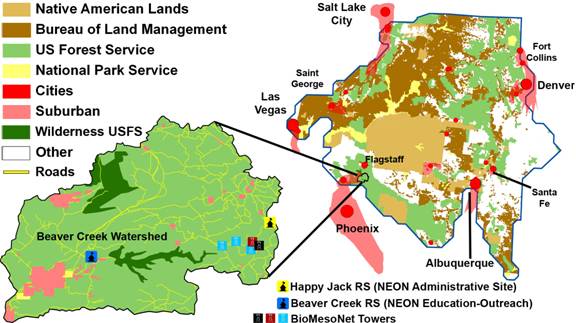 Figure 5.
 Approximately 83% of Domain 13 is owned by three federal land management agencies and Native American Nations. Centers of human populations are found on the boundaries of the domain. The Beaver Creek inset shows that 91% of the watershed is managed by the USFS and NPS. Recreational pressures occur throughout and human developments are growing rapidly in the southern portion of the watershed.
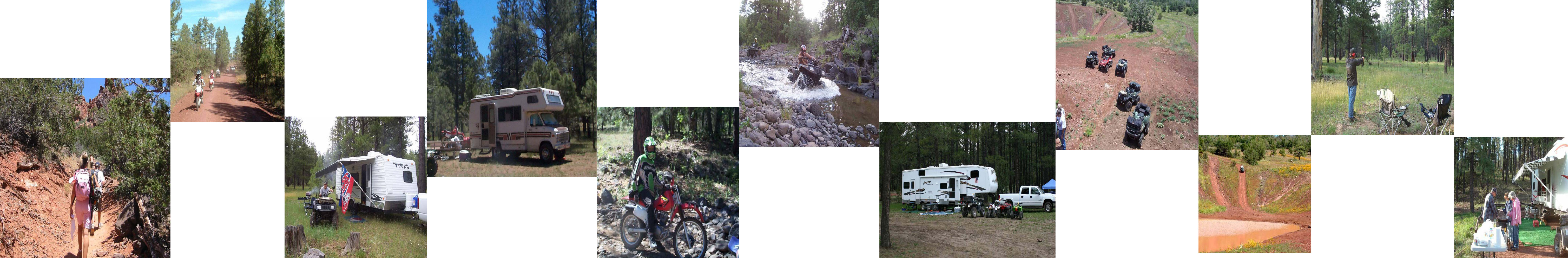
Recreational Use