The climate of the Beaver Creek Watershed (BCW) mirrors the climate of Domain 13, based on an analysis of 800m PRISM data. Climate data summarized in Table 2 shows that the mean climate and elevation values for the BCW are remarkably close to those of Domain 13. The seasonality of precipitation in the Intermountain West is thought to be equally important as total precipitation. The proportion of annual average precipitation received during the monsoon season (from high to low elevation sites in the watershed) brackets that of Domain 13, underscoring how well it is able to represent Domain 13 in terms of seasonal moisture receipt (See
Table 2 and
Figure 2).
Click here for more detailed information on the Beaver Creek Watershed's climate
Table 2. Climate and elevation characteristics for Domain 13 and the Beaver Creek Watershed (PRISM Group, 2004). Note: the proposed BioMesoNet Tower sites are located in the high elevation portion of the watershed.

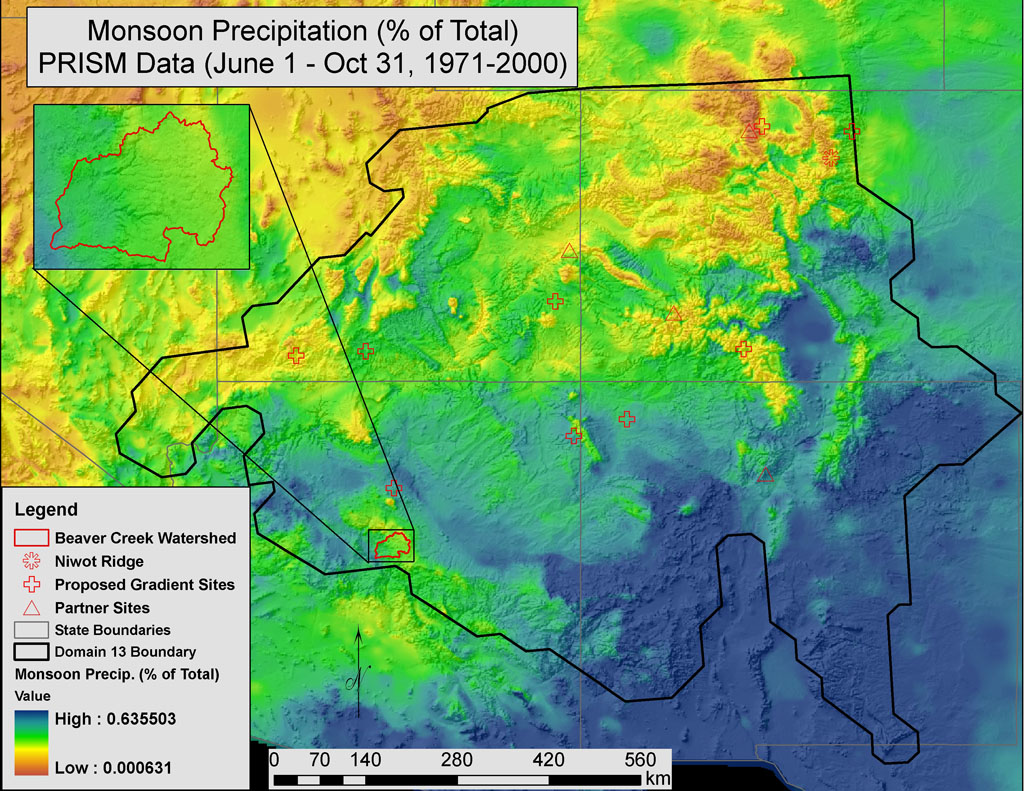 Figure 2.
 The Beaver Creek Watershed ranges from low-moderate to high monsoon precipitation receipt, making it an ideal location for detecting the affects of climate change on monsoonal patterns.
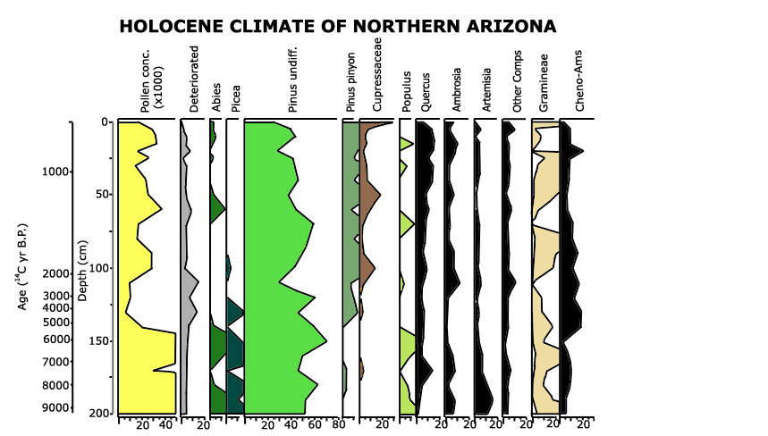
9000 years of climate change as evidenced by vegetation change